One Day in Death Valley: The Ultimate Road Trip Itinerary
Death Valley September 2024
If you're wondering whether it's possible to experience Death Valley National Park in just one day, the answer is yes. While you'll barely scratch the surface of the largest national park in the contiguous United States, you can still visit many of its most iconic landmarks by following a carefully planned route.
This itinerary begins at the southern entrance via Death Valley Junction before crossing the park from east to west. Along the way you'll visit panoramic viewpoints, colourful badlands, ancient salt flats, towering sand dunes and some of the most surreal landscapes anywhere in America.
Whether you're driving between Las Vegas and California or, fresh from spending time in Joshua Tree National Park, as we were, this route packs in the very best things to do in Death Valley.
Dante's View
Entering the park from the south at Death Valley Junction, follow highway 190 for approximately 18 miles, then turn left to go south for 14 miles to begin the climb to Dante's View, one of the highest viewpoints in Death Valley National Park.
Perched over 5,500 feet above sea level, this spectacular viewpoint offers one of the best panoramic views in Death Valley. From the viewing platform you'll be able to look across the entire valley floor towards the Panamint Mountains, with Badwater Basin visible far below.
There are toilets at the car park, making this a convenient first stop before continuing your journey.
Afterwards, return north along the same road until you get back to Highway 190, and turn left to continue towards Twenty Mule Team Canyon.
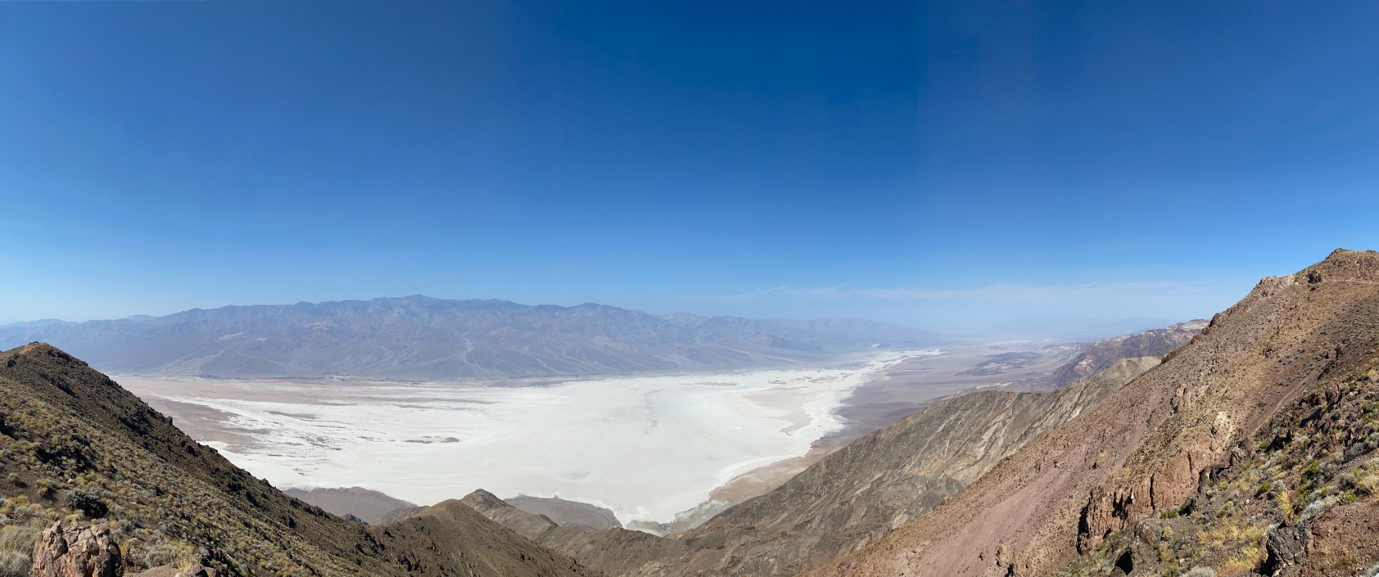
Dante's View, Death Valley
Twenty-Mile Team Canyon
At Twenty-Mule Team Canyon, visitors can explore a roller-coaster drive, hidden just off the main highway.
Here, a 2.5 mile dirt road winds between, around, and over yellow hills. This one-way drive offers spectacular scenery, and a taste of the ruggedness of Death Valley.
Although this road is usually passable by most vehicles, check current conditions at the Furnace Creek Visitor Centre before heading out.
We will pass the exit road of the loop first, which you can’t drive down. Continue to the next left turn and drive south and anti-clockwise until we are back at Highway 190 again.
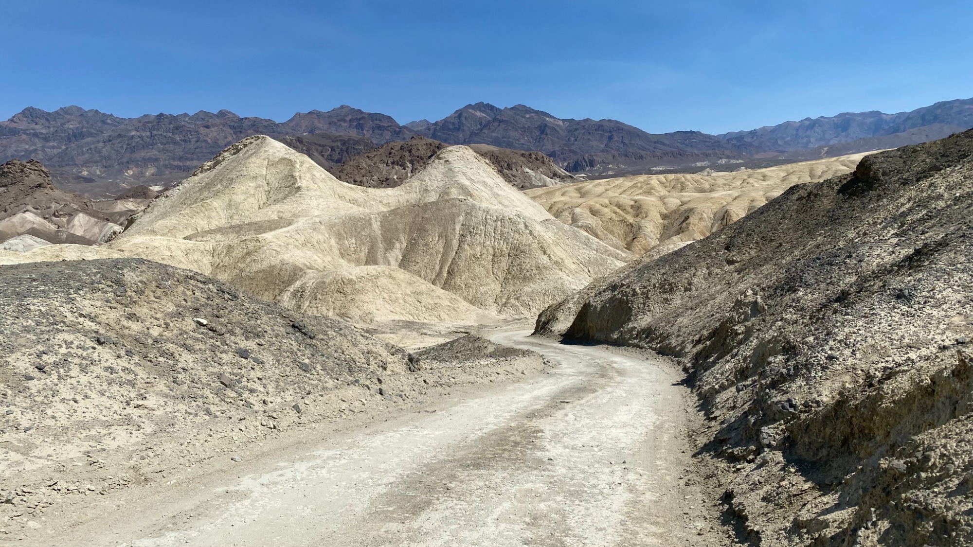
Twenty-Mule Team Canyon, Death Valley
Zabriskie Point
Just 3 miles further along, to your left, is one of Death Valley's most photographed locations.
A short, paved 400-metre walk leads uphill to Zabriskie Point, where rolling golden badlands stretch as far as the eye can see. The colours are especially beautiful during the early morning when the sunlight brings the landscape to life.
Toilets are also available here.
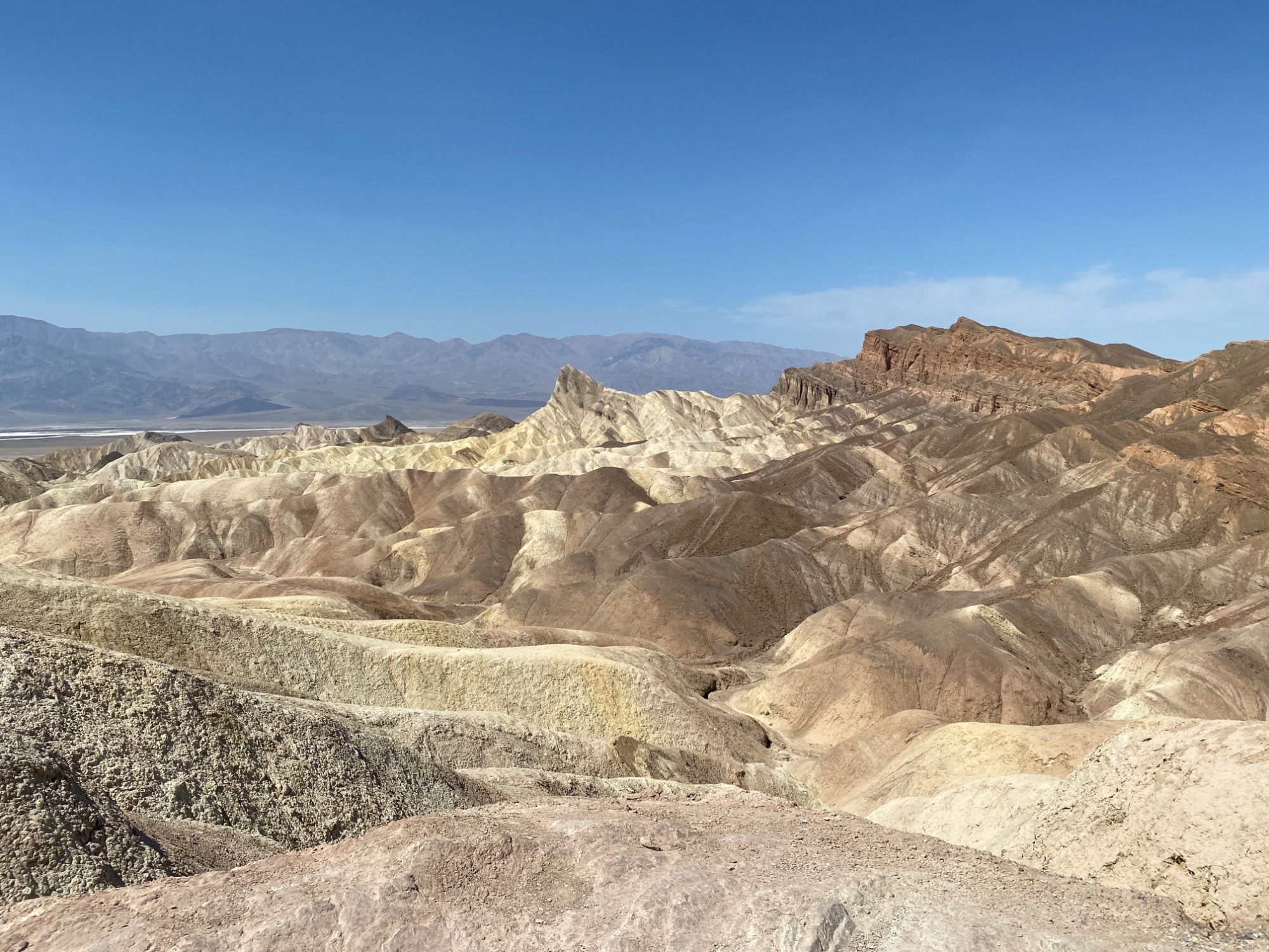
Zabriskie Point, Death Valley
Furnace Creek
Continue west to Furnace Creek, the main visitor hub within the national park.
This is the perfect place to refill water bottles, grab lunch or snacks, browse the Visitor Center and, of course, take the obligatory photo beside the famous Death Valley thermometer.
From here, head south onto Badwater Road to continue your adventure.
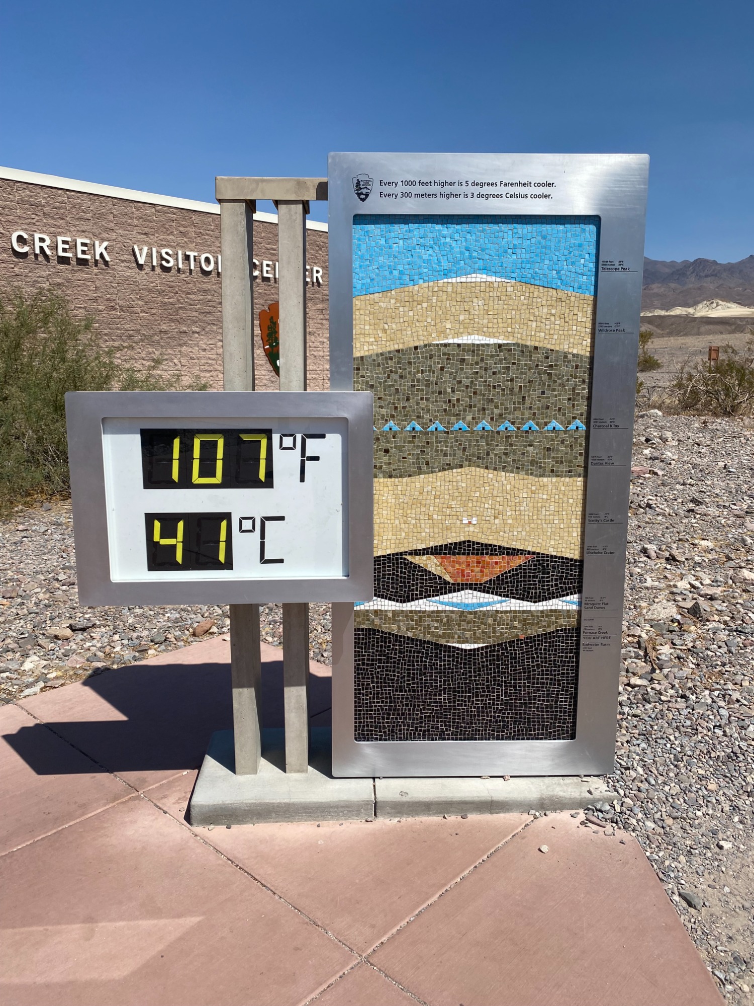
Furnace Creek Thermometer, Death Valley
Golden Canyon
Just outside Furnace Creek lies Golden Canyon, one of the park's most popular walks.
The relatively easy two-mile return walk follows a colourful canyon carved through golden rock formations and has featured in several Hollywood films, including Star Wars.
If you're visiting during the warmer months, try to complete this walk before 10am. Once the desert heat begins to build, it's far more comfortable, and much safer, to continue exploring by car.
Golden Canyon, Death Valley
Devil's Golf Course
Continuing south, and around 8 miles south of Furnace Creek is the right hand turn into Devils Golf Course.
An immense area of rock salt eroded by wind and rain into jagged spires. So incredibly serrated that "only the devil could play golf on such rough links." Listen carefully and you'll hear sounds like tiny pops and pings, the sound is literally billions of tiny salt crystals bursting apart as they expand and contract in the heat.
The formations can be appreciated from the roadside if temperatures are too extreme.
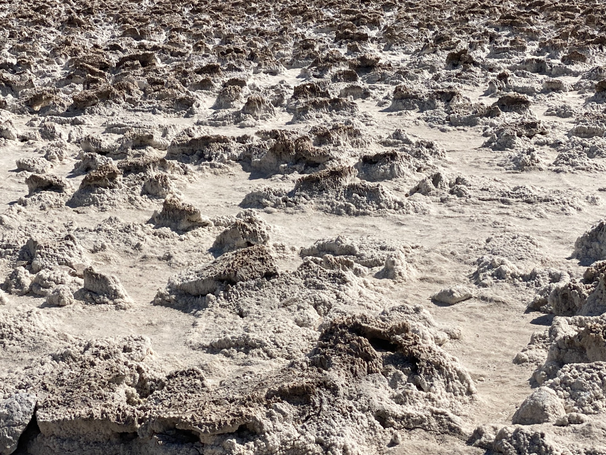
Devil's Golf Course, Death Valley
Natural Bridge
A short drive further south brings you to Natural Bridge.
An easy walk up the dry wash leads beneath this impressive natural rock bridge, which rises around 35 feet above the canyon floor. Despite Death Valley's arid appearance, this bridge was carved over thousands of years by powerful flash floods.
The walk is relatively short but is best avoided during the hottest hours of the day.
Turning back onto the main road south again (turning left), after approximately 4 miles we will come to the last place on the road before turning around and heading north again.
Badwater Basin
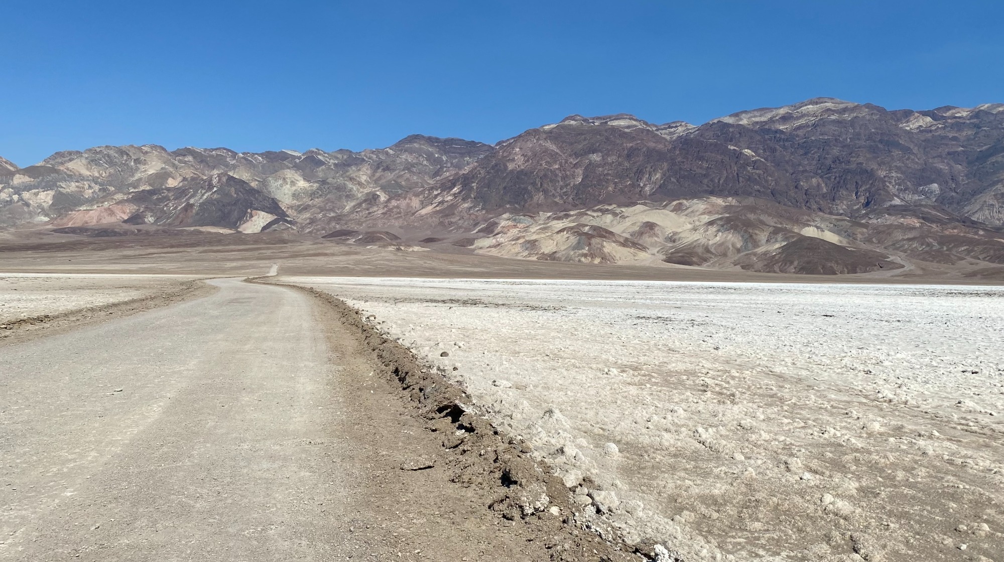
No visit to Death Valley would be complete without standing at Badwater Basin, the lowest point in North America at 282 feet below sea level.
The vast white salt flats stretch towards the mountains in every direction, creating one of the most iconic landscapes in the American Southwest. Even a short walk onto the brilliant white salt crust is enough to appreciate the sheer scale of this remarkable place.
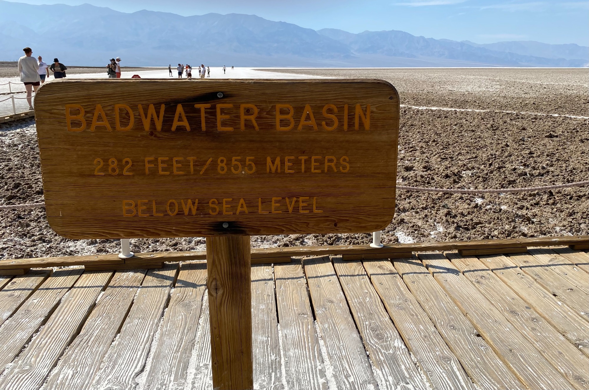
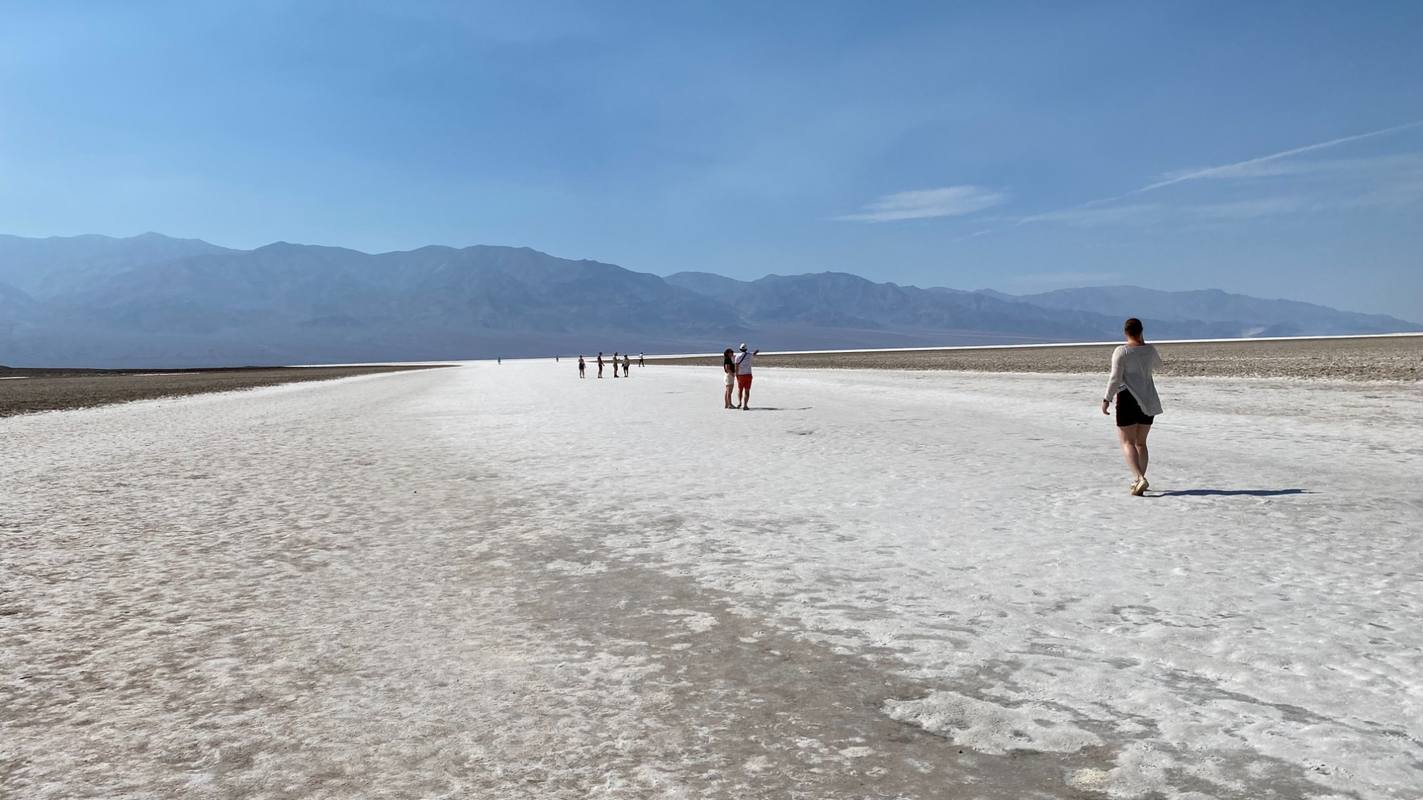
Badwater Basin, Death Valley
Artist's Drive and Artist's Palette
Retrace your route north for approximately 5 miles, there will be a right hand turn onto Artist's Drive, a spectacular 9 mile scenic loop.
This winding road passes hills painted in shades of green, pink, purple and turquoise, created by naturally occurring minerals within the volcanic rock. The highlight is Artist's Palette, where a short walk from the car park reveals the park's most colourful landscape.
If your schedule allows, aim to arrive during the late afternoon when the lower sun brings the colours vividly to life. The sun was still a little too high in the sky when we got there, so the colours were more muted.
After this, get back on to the main road heading north (turn right out of Artists Drive) and head back towards Furnace Creek.
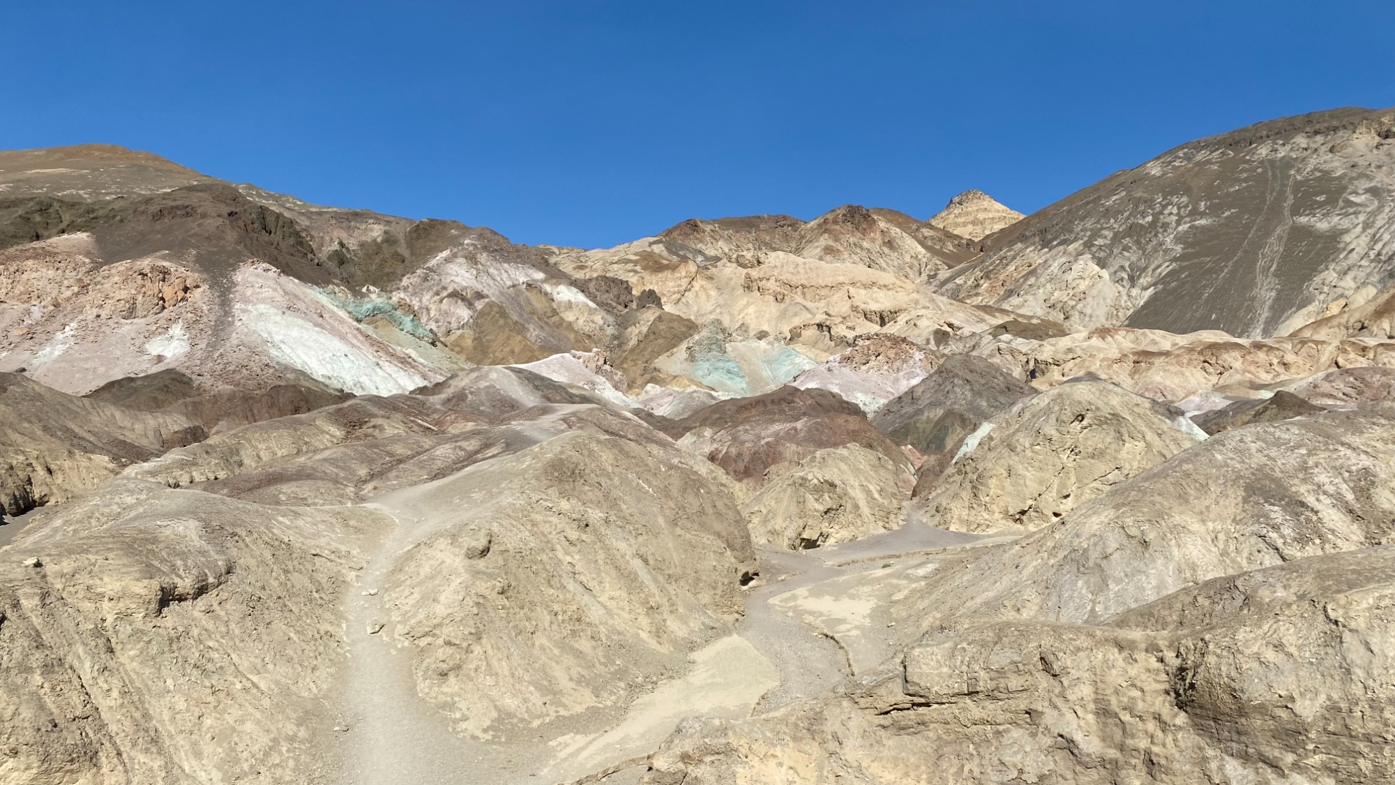
Artist's Palette, Death Valley
Mesquite Flat Sand Dunes
Continue west through Furnace Creek for 28 miles on Highway 190 towards Mesquite Flat Sand Dunes, the park's most accessible dune field.
Rolling waves of golden sand rise up to 100 feet high, creating one of Death Valley's most recognisable landscapes. Around sunrise and sunset, the low-angle light creates beautiful ripples and long shadows across the dunes, making this one of the best photography spots in the park.
If temperatures are too high, the dunes can still be admired from the roadside.
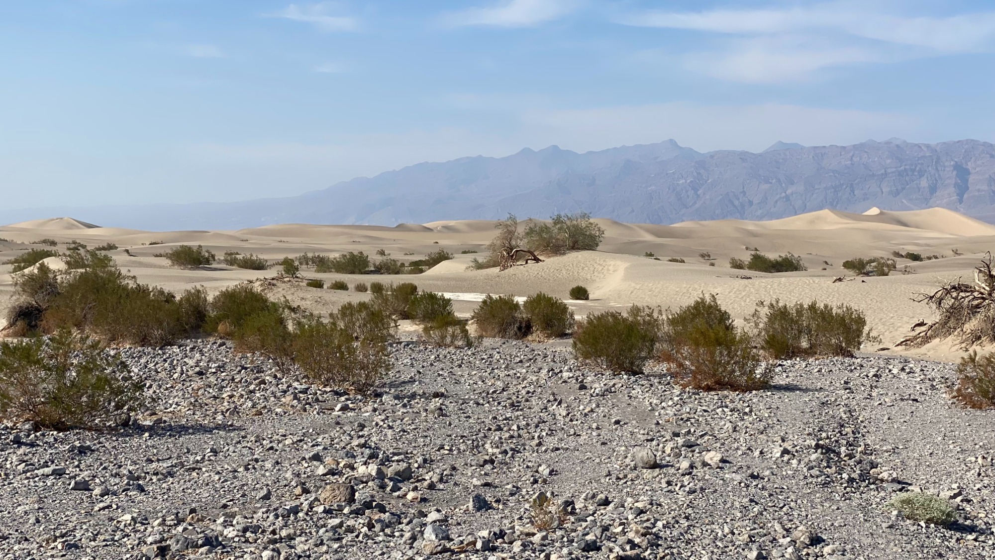
Mesquite Flat Sand Dunes, Death Valley
Stovepipe Wells
Just a minute or two beyond the dunes (still heading west on Highway 190) lies Stovepipe Wells Village, a useful place to stop for fuel, refreshments or a comfort break before the final stretch of your journey.
Panamint Springs
Another 26 miles along Highway 190 is Panamint Springs, another small desert outpost surrounded by rugged mountain scenery.
Although many visitors simply drive through, it's another opportunity to refuel and enjoy one last break before reaching the western exit of Death Valley National Park.
Father Crowley Overlook
Round off your day at Father Crowley Overlook, one of Death Valley's lesser-known viewpoints.
A few miles outside Panamint Village is Father Crowley outlook. A view into Rainbow Canyon (also now called Star Wars Canyon) is a short walk from the car.
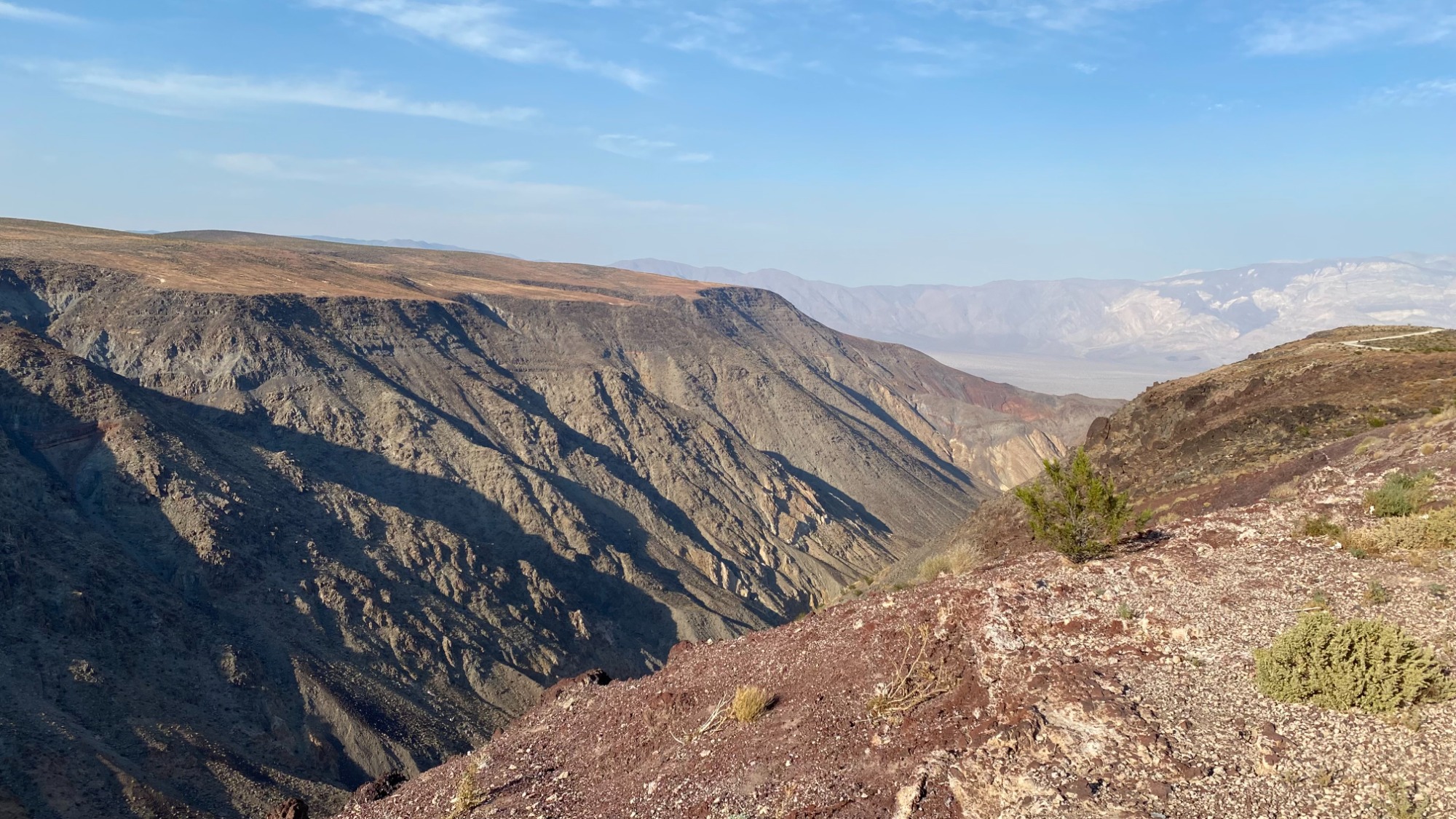
Father Crowley Outlook, Death Valley
Suggested Timings
8.00am – Enter Death Valley via Death Valley Junction
7.45am – Dante's View
9.00am – Twenty Mule Team Canyon
9.45am – Zabriskie Point
10.30am – Furnace Creek
11.30am – Golden Canyon
12.15pm – Devil's Golf Course
12.45pm – Natural Bridge
1.30pm – Badwater Basin
3.30pm – Artist's Drive & Artist's Palette (best when the sun is lower in the sky)
5.30pm – Mesquite Flat Sand Dunes
6.00pm – Stovepipe Wells
6.45pm – Panamint Springs
7.15pm – Father Crowley Overlook (check sunset times for the best views)
Tips for Visiting Death Valley
One day is never enough to see everything Death Valley National Park has to offer, but this route showcases many of its most unforgettable landscapes while keeping driving to a minimum. From soaring viewpoints and colourful canyons to ancient salt flats and towering sand dunes, you'll experience a remarkable variety of scenery in just a single day.
- Start early
- Carry far more water than you think you'll need.
- Fill up with fuel whenever possible - petrol stations are few and far between.
- Download offline maps before entering the park, as mobile signal is extremely limited.
- Check road conditions at the Furnace Creek Visitor Center, particularly before driving Twenty Mule Team Canyon.
- Wear sturdy footwear, sunscreen and a hat, even for short walks.
- Avoid strenuous hiking during the middle of the day, especially between late spring and early autumn.
FAQs
What is the best route through Death Valley?
Our itinerary is one of the most efficient routes, and enters via Death Valley Junction, travels south to Badwater Basin, then heads west past Mesquite Flat Sand Dunes before leaving through Panamint Springs.
What is the best time of the year to visit Death Valley?
The cooler months from November to March offer the most comfortable temperatures for sightseeing and hiking. Summer temperatures frequently exceed 45°C (113°F), making many activities unsafe during the day. We went in September, and I think that was a mistake. It was 41°C, and I would have liked to have spent longer outside the car.